Map Overview
The Telerik and Kendo UI Map component allows you to display geospatial information organized in layers. You can connect the component to various online providers, such as OpenStreetMap, OpenWeatherMap, ArcGIS, Azure, and many more.
The Map component includes tile, shape bubble, and marker layers. It also provides support for the GeoJSON data format.
Live Demo
Anatomy
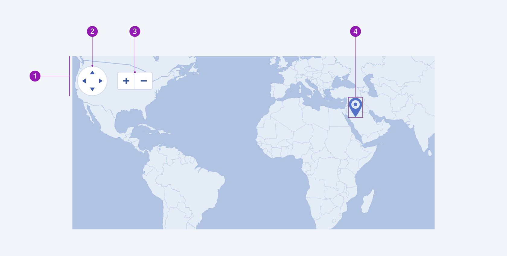
The anatomy of the Map summarizes the elements of the component:

- Map controls
- Navigator
- Zoom control
- Marker
Layer Views
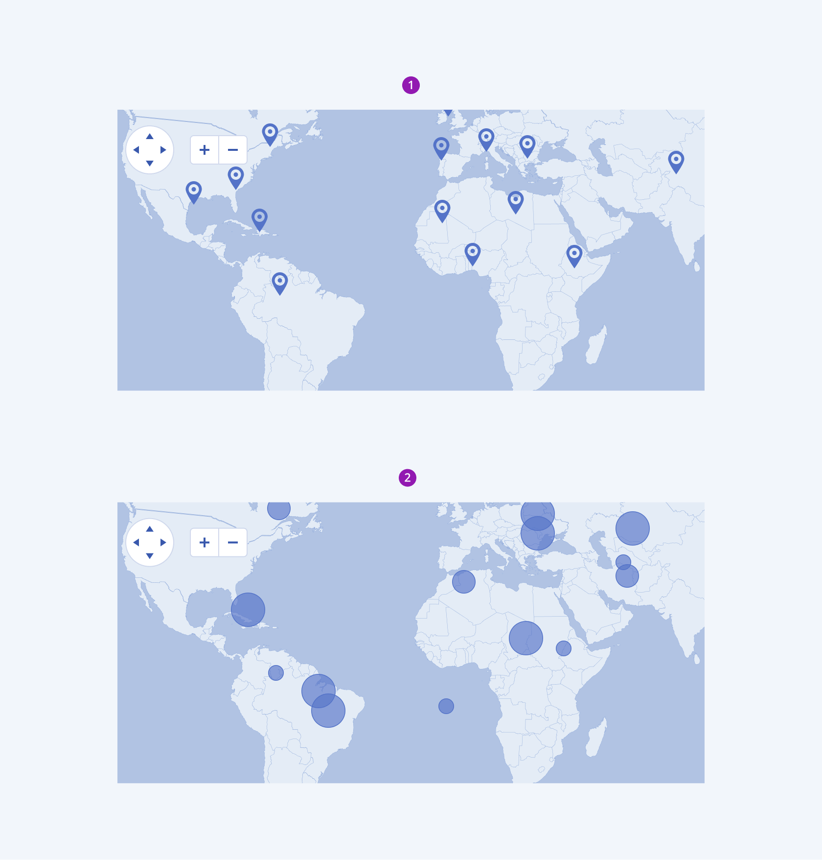
The Telerik and Kendo UI Map component has built-in layer options that let you configure the visualization of locations:
- Marker Layer—Displays a marker over a specific location.
- Bubble Layer—Displays bubbles over another layer to mark regions.

- Marker layer
- Bubble layer
Framework-Specific Documentation
For specific information about the component, refer to its official product documentation:


