
UI for WinUI
WinUI Map
- The best in class Telerik WinUI Map visualizes rich geographical information right into your new desktop application! It allows you to visualize data from external sources, supports pan, zooming functionality and much more.
- Part of the professionally-designed Telerik UI for WinUI library controls.
- Includes support, documentation, demos, Visual Studio Extensions and more!
-
Overview
The Map control enables you to visualize rich geographical information right into your WinUI application! The control is highly configurable and allows you to visualize data from external sources, supports pan and zooming functionality, and gives users the ultimate flexibility with various navigation capabilities like command bar and scale control.
To get started with the Telerik UI for WinUI Map control, visit our product documentation.
-
Visualization Layer
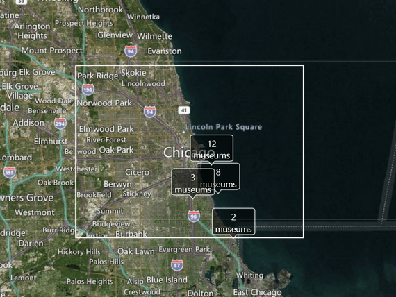
The visualization layer of the Map control for WinUI allows you to display additional data on top of the displayed map. The control supports the displaying of various item types such as charts and images, map shapes such as path, and pinpoints. You can easily display multiple items within a single visualization layer, which gives you ultimate flexibility in customizing your map.
-
Support for Various Map Sources
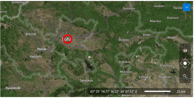
The visualization of maps comes from external map providers such as Bing and OpenStreet Maps. You can easily define one or more of the following providers that are currently supported by the Telerik Map control:
-
Navigation Controls
The Map control for WinUI provides ultimate navigation flexibility with a command bar for switching between the different views, a zoom bar control for controlling the zoom level and out-of-the-box scale control.
-
Flexible Zoom Modes
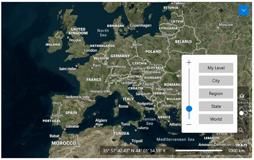
The zooming functionality of the WinUI Map control enables the end users of your application to easily zoom in and out via a slider that is open to a variety of customizations. You can easily customize the zoom functionality by defining everything from its’ maximum to minimum zoom levels, the visibility of the zoom bar, as well as the ability to zoom via a mouse scroll.
For more information on the Zoom Modes for the WinUI Map control, visit our product documentation.
-
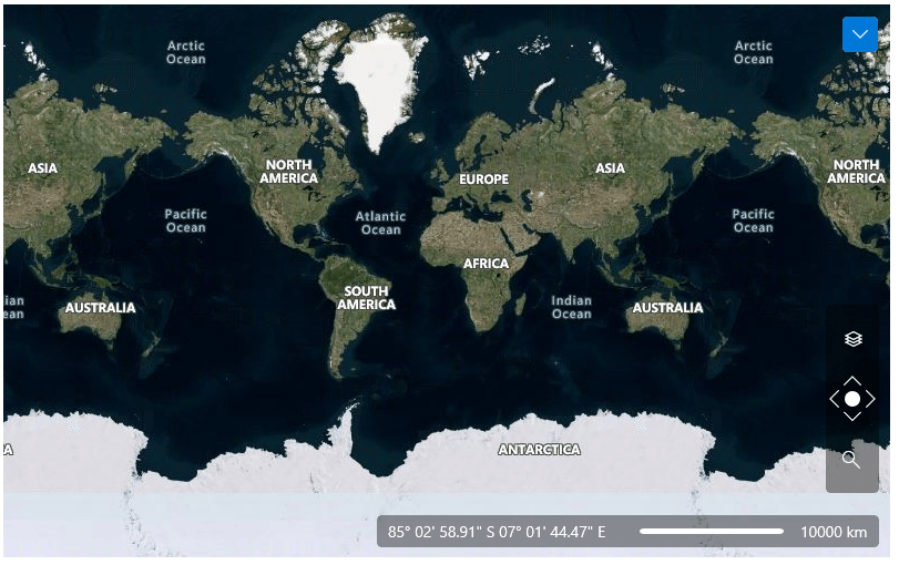
Pan and Wraparound
In addition to zooming, the Telerik Map control for WinUI supports panning through the mouse, keyboard or the navigation controls. Additionally, a wraparound feature provides infinite horizontal panning which gives continuous experience as the user pans the viewport east or west.
Documentation on Pan and Wraparound for Telerik UI for WinUI Map control.
-
Built-in Geocoding Support
The Telerik UI for WinUI Map control comes with a built-in support for geocoding that turns a textual representation of a place or address into a map representation of its location.
-
Searching and Routing
The Telerik UI for WinUI Map control comes with a built-in search mechanism and Bing Maps routing support.
-
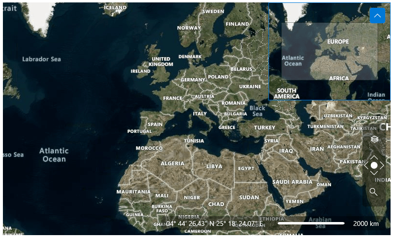
Mini Map
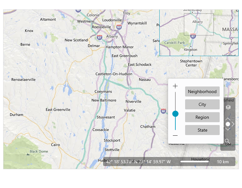
The Map control for WinUI provides a Mini Map functionality, where a focused portion of the map can be expanded or collapsed from the corner of the Map control. The Mini Map control is enabled by default. The Mini Map control can also be used as a separate control like other map controls such as map navigation, scale and mouse location control.
All UI for WinUI Components
Data Management
Scheduling
Interactivity & UX
Navigation
Document Processing
