New to Telerik UI for WPF? Start a free 30-day trial
Wms Tile Provider
Updated on Feb 25, 2026
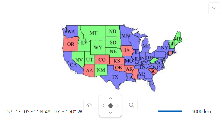
The RadMap control allows you to display map tiles from a Web Map Service (WMS) server. WMS is a standard protocol for serving georeferenced map images over the internet. The WmsTiledProvider provider enables you to connect to a WMS server and display the map tiles it provides.
The WmsTiledProvider provides the following properties:
BaseUrl- Gets or sets the URL of the WMS server.Layers- Gets or sets the Layers tag of the downloaded map tiles.Version- Gets or sets the VERSION tag of the downloaded map tiles.ImageFormat- Gets or sets the FORMAT tag of the downloaded map tiles (e.g., "image/png").
The following example showcases how to use the WmsTiledProvider to display map tiles from a WMS server, via GeoServer:
XAML
    <telerik:RadMap>
    	<telerik:RadMap.Provider>
    		<telerik:WmsTiledProvider BaseUri="http://localhost:8080/geoserver/wms"
    								  Layers="topp:states"
    								  Version="1.1.0"
    								  ImageFormat="image/jpeg"/>
    	</telerik:RadMap.Provider>
    </telerik:RadMap>
RadMap displaying map tiles from a WMS server