ArcGIS Online Map Provider
The ArcGIS online services can be used via the ArcGisMapProvider class.
To use the ArcGIS vector tile services refer to the Migrating to Vector Tile Map Provider section of this article.
Currently the ArcGIS map provider support six modes which specify the type of appearance of the map can and be set using the Mode property:
- Aerial
- Physical
- Shaded Relief
- Street
- Terrain
- Topographic
The following example of the ArcGisMapProvider definition uses the Physical mode:
Defining the ArcGisMapProvider in XAML
	<telerik:RadMap x:Name="radMap" ZoomLevel="1">
		<telerik:RadMap.Provider>
			<telerik:ArcGisMapProvider Mode="Physical" />
		</telerik:RadMap.Provider>
	</telerik:RadMap>
Defining the ArcGisMapProvider in code-behind
	ArcGisMapProvider provider = new ArcGisMapProvider();
	provider.Mode = ArcGisMapMode.Physical;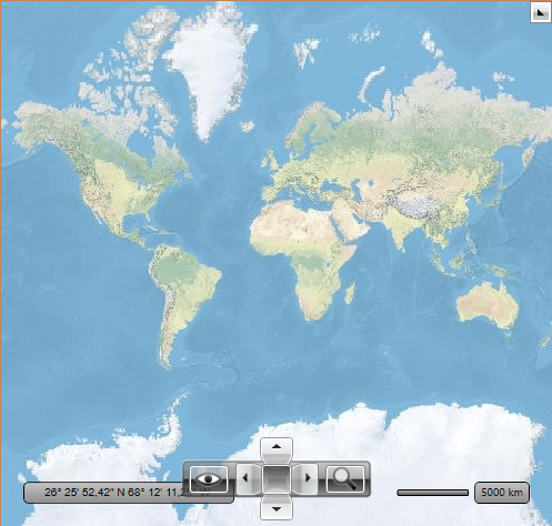
this.radMap.Provider = provider;ArcGisMapProvider when using the Physical mode
Attribution Copyright Label
When using the ArcGisMapProvider, you have to display an attribution copyright label to the ArcGis services. To learn more about the accurate copyright label's content, please refer to the Esri and data attribution article.
To learn how to customize the RadMap to allocate space for displaying an element containing a sample attribution copyright label, check this article.
Security Protocol
ArcGIS Online services only accept connections using TLS 1.2. Thus, you need to explicitly set the ServicePointManager.SecurityProtocol property if you're using a .NET Framework version prior to 4.7.
Setting the ServicePointManager.SecurityProtocol
	public App()
	{
		// ArcGis rest services require TLS 1.2 protocol.
		ServicePointManager.SecurityProtocol = (SecurityProtocolType)3072;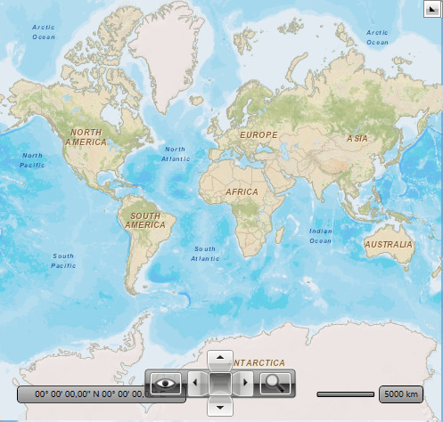
}For comparison, the following snapshot demonstrates the appearance of the map for the Street mode:
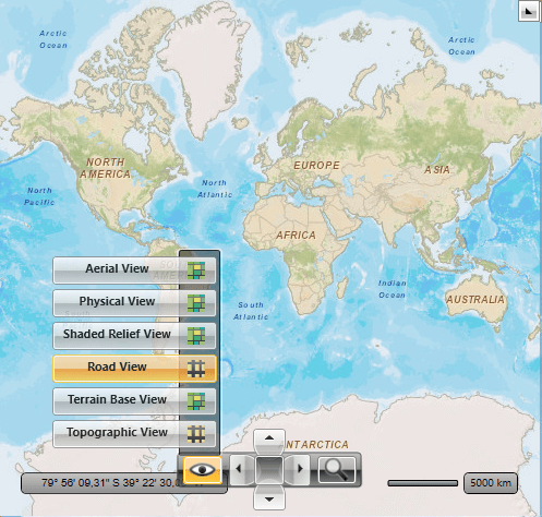
The ArcGisMapProvider also allows the user to change the map mode using the Map View button of the toolbar.
Migrating to Vector Tile Map Provider
To migrate to a vector-based tile provider that uses the ArcGIS vector tile services you can create a custom vector tile providers. The Custom Vector Tile Provider article demonstrates how to do this.
Additional to this, as of 2023, part of the ArcGIS raster-based services are obsolete and no longer supported. The following list shows the end-points of the map layers that are obsolete and if they have alternatives in the vector-based services.
| Map Layer | Old Address | New Address |
|---|---|---|
| Physical | https://www.arcgis.com/home/item.html?id=c4ec722a1cd34cf0a23904aadf8923a0 | no longer supported |
| ShadedRelief | https://www.arcgis.com/home/item.html?id=9c5370d0b54f4de1b48a3792d7377ff2 | no longer supported |
| Streets (world streets) | https://www.arcgis.com/home/item.html?id=3b93337983e9436f8db950e38a8629af | https://www.arcgis.com/home/item.html?id=de26a3cf4cc9451298ea173c4b324736 |
| Terrain (world terrain) | https://www.arcgis.com/home/item.html?id=c61ad8ab017d49e1a82f580ee1298931 | no longer supported |
| Topographic (world topographic) | https://www.arcgis.com/home/item.html?id=30e5fe3149c34df1ba922e6f5bbf808f | https://www.arcgis.com/home/item.html?id=7dc6cea0b1764a1f9af2e679f642f0f5 |